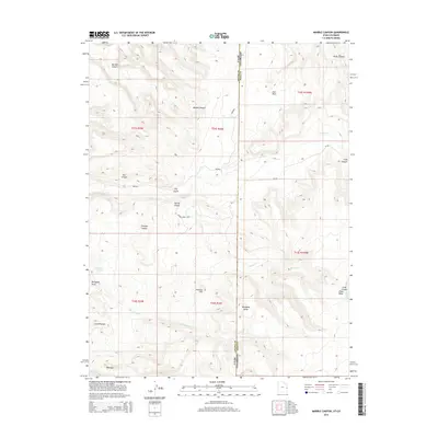
2014 Map of Marble Canyon
USGS Topo · Published 2014About this map
Marble Canyon and the high tablelands of the Grand Co Mesa Co border define this 2014 survey along the Utah Colorado state line. The map captures a landscape of deep drainage systems and named plateaus, where the Spring Creek Rnch represents the primary human footprint in a region dominated by relief. Significant water sources like Horseshoe Spring and various ephemeral drainages such as Renegade Cr and Coach Cr dictate the character of the terrain. The presence of Flatiron Hill and the Cook Canyon Piñon Mesa suggests a geologically complex area used for cattle ranching and seasonal grazing. Local landmarks like Red Gap and Little Triangle provide specific navigational points within the network of canyons and draws that feed into the larger basin system.
Find a feature on this map
32 named features on this map. Tap any name to fly to it.
Don’t see what you’re looking for? This feature index may not catch every label — zoom into the map to look around manually.
Map Details
Editions of this 2014 Marble Canyon Map
This is the sole edition of this map. No revisions or reprints were ever made.
Other maps of this area

1885 · East Tavaputs
USGS Topo · 1:250,000

1885 · La Sal
USGS Topo · 1:250,000

1954 · Westwater 4 SW
USGS Topo · 1:24,000

1954 · Mt. Waas 1 SW
USGS Topo · 1:24,000

1954 · Mt. Waas 1 NE
USGS Topo · 1:24,000

1954 · Mt. Waas 1 NW
USGS Topo · 1:24,000

1954 · Mt. Waas 1 SE
USGS Topo · 1:24,000

1954 · Coates Creek
USGS Topo · 1:62,500

1956 · Westwater 4 SE
USGS Topo · 1:24,000

1956 · Moab
USGS Topo · 1:250,000