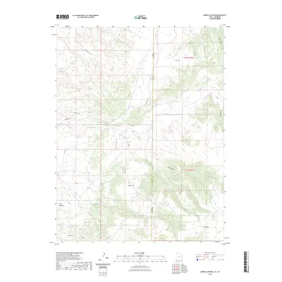
2023 Map of Marble Canyon
USGS Topo · Published 2023About this map
Spring Creek Rnch sits at the heart of this high-desert landscape, where the state boundary between Utah and Colorado meets the county line for Grand and Mesa counties. The terrain is defined by a dense network of drainage systems, including the namesake Marble Canyon and the winding course of Coates Creek. These canyons and gulches dictate the placement of local infrastructure, such as the DS Rd and Ryan Creek road, which navigate around significant elevations like Piñon Mesa and Flatiron Hill.
Find a feature on this map
25 named features on this map. Tap any name to fly to it.
Don’t see what you’re looking for? This feature index may not catch every label — zoom into the map to look around manually.
Map Details
Editions of this 2023 Marble Canyon Map
This is the sole edition of this map. No revisions or reprints were ever made.
Other maps of this area

1885 · East Tavaputs
USGS Topo · 1:250,000

1885 · La Sal
USGS Topo · 1:250,000

1954 · Westwater 4 SW
USGS Topo · 1:24,000

1954 · Mt. Waas 1 SW
USGS Topo · 1:24,000

1954 · Mt. Waas 1 NE
USGS Topo · 1:24,000

1954 · Mt. Waas 1 NW
USGS Topo · 1:24,000

1954 · Mt. Waas 1 SE
USGS Topo · 1:24,000

1954 · Coates Creek
USGS Topo · 1:62,500

1956 · Westwater 4 SE
USGS Topo · 1:24,000

1956 · Moab
USGS Topo · 1:250,000