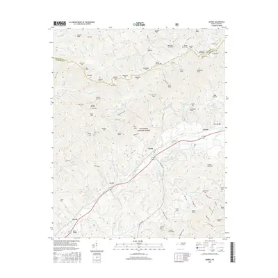
2016 Map of Marble
USGS Topo · Published 2016About this map
The Valley River corridor serves as the primary artery for settlement and transport in this Cherokee County landscape, where small communities like Marble, Maltby, and Tomotla follow the valley floor. To the north, the terrain rises sharply into the Snowbird Mountains and the vast protected lands of the Nantahala National Forest. This 2016 survey documents a network of named ridges and gaps, such as Porterfield Gap and Isinglass Ridge, that have historically defined movement through these highlands. For genealogists and local historians, the map preserves the location of family-centered landmarks and resting places, including Moss Cem and Parker Cem. The presence of Sales Ford on the river and old routes like Plankroad Rd reflect the early infrastructure that connected these mountain settlements before modern highway developments.
Find a feature on this map
164 named features on this map. Tap any name to fly to it.
Don’t see what you’re looking for? This feature index may not catch every label — zoom into the map to look around manually.
Map Details
Editions of this 2016 Marble Map
This is the sole edition of this map. No revisions or reprints were ever made.
Other maps of this area

1893 · Murphy
USGS Topo · 1:125,000

1914 · Murphy
USGS Topo · 1:125,000

1927 · Big Junction
USGS Topo · 1:24,000

1933 · Haw Knob
USGS Topo · 1:48,000

1934 · Murphy
USGS Topo · 1:24,000

1934 · McDaniel Bald
USGS Topo · 1:24,000

1934 · Murphy
USGS Topo · 1:48,000

1935 · Peachtree
USGS Topo · 1:24,000

1935 · Robbinsville
USGS Topo · 1:24,000

1935 · Marble
USGS Topo · 1:24,000