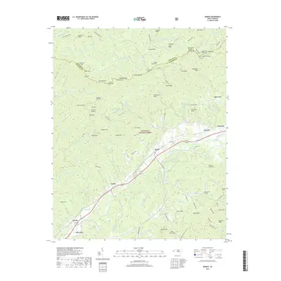
2019 Map of Marble
USGS Topo · Published 2019About this map
The Valley River serves as the central artery for this portion of western North Carolina, carving a path through the valley where several historic communities established themselves along the roadway and rail corridor. Small settlements like Marble, Maltby, and Tomotla are concentrated in this low-lying area, while the surrounding landscape is defined by the dense, protected woodlands of the Nantahala National Forest. The map provides significant genealogical value through the location of the Moss Cem and Parker Cem, which sit near the river's edge.
Find a feature on this map
156 named features on this map. Tap any name to fly to it.
Don’t see what you’re looking for? This feature index may not catch every label — zoom into the map to look around manually.
Map Details
Editions of this 2019 Marble Map
This is the sole edition of this map. No revisions or reprints were ever made.
Other maps of this area

1893 · Murphy
USGS Topo · 1:125,000

1914 · Murphy
USGS Topo · 1:125,000

1927 · Big Junction
USGS Topo · 1:24,000

1933 · Haw Knob
USGS Topo · 1:48,000

1934 · Murphy
USGS Topo · 1:24,000

1934 · McDaniel Bald
USGS Topo · 1:24,000

1934 · Murphy
USGS Topo · 1:48,000

1935 · Peachtree
USGS Topo · 1:24,000

1935 · Robbinsville
USGS Topo · 1:24,000

1935 · Marble
USGS Topo · 1:24,000