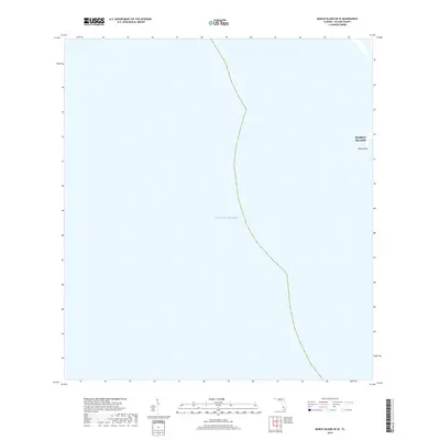
2018 Map of Marco Island OE W
USGS Topo · Published 2018About this map
Marco Island meets the open waters of the Gulf of Mexico on this 2018 coastal survey. This specific chart covers the western edge of the island, focusing on the interface between the shoreline and the sea. The most prominent landform is South Point, which marks the southwestern extremity of the island. Beyond this point, the map illustrates the maritime boundary and the vast expanse of the gulf, providing a clear view of the coastal geometry as it existed in the late 2010s. Because the sheet focuses heavily on the offshore area, it provides a clean perspective on the natural curve of the island's Gulf-side frontage.
Find a feature on this map
3 named features on this map. Tap any name to fly to it.
Don’t see what you’re looking for? This feature index may not catch every label — zoom into the map to look around manually.
Map Details
Editions of this 2018 Marco Island OE W Map
This is the sole edition of this map. No revisions or reprints were ever made.
Other maps of this area

1956 · Miami
USGS Topo · 1:250,000

1956 · West Palm Beach
USGS Topo · 1:250,000

1957 · West Palm Beach
USGS Topo · 1:250,000

1958 · West Palm Beach
USGS Topo · 1:250,000

1958 · Miami
USGS Topo · 1:250,000

1958 · Belle Meade
USGS Topo · 1:24,000

1958 · Naples South
USGS Topo · 1:24,000

1973 · Cape Romano
USGS Topo · 1:24,000

1973 · Marco Island
USGS Topo · 1:24,000

1982 · Everglades City
USGS Topo · 1:100,000