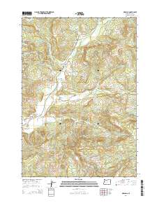
2014 Map of Marcola
USGS Topo · Published 2014About this map
The Mohawk River flows through the heart of the Mohawk Valley, providing a central axis for the small settlements of Mabel and Wendling. This portion of Lane County is defined by its transition from the valley floor to the prominent heights of the Coburg Hills and Windy Point. For local historians and genealogists, the map identifies specific burial grounds including Mabel Cem and Upper Mabel Cem, alongside local landmarks like Earnest Bridge. The landscape is heavily marked by a network of timber and access roads, such as Mohawk River Rd and various Bureau of Land Management routes, indicating the area's continued reliance on the surrounding forest resources. Small tributaries like Mill Cr and Cartwright Cr cut through the rising terrain, which includes notable elevations such as Drury Butte and Bunker Hill.
Find a feature on this map
70 named features on this map. Tap any name to fly to it.
Don’t see what you’re looking for? This feature index may not catch every label — zoom into the map to look around manually.
Map Details
Editions of this 2014 Marcola Map
This is the sole edition of this map. No revisions or reprints were ever made.
Other maps of this area

1921 · Brownsville
USGS Topo · 1:62,500

1950 · Marcola
USGS Topo · 1:62,500

1950 · Brownsville
USGS Topo · 1:62,500

1951 · Sweet Home
USGS Topo · 1:62,500

1951 · Leaburg
USGS Topo · 1:62,500

1952 · Brownsville
USGS Topo · 1:62,500

1952 · Marcola
USGS Topo · 1:62,500

1953 · Salem
USGS Topo · 1:250,000

1954 · Salem
USGS Topo · 1:250,000

1960 · Salem
USGS Topo · 1:250,000