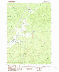
1988 Map of Marcola
USGS Topo · Published 1988About this map
The Mohawk Valley landscape in Lane County is defined by the winding course of the Mohawk River and a network of logging and recreation roads in the late 1980s. The settlement of Marcola serves as a local hub, situated near the river and the Cem cemetery, while smaller communities like Wendling, Mabel, and Cartwright are dispersed throughout the timbered hills. The map captures the transitional infrastructure of the era, noting landmarks such as the Ernest Bridge and a Covered Bridge crossing Mill Creek.
Find a feature on this map
31 named features on this map. Tap any name to fly to it.
Don’t see what you’re looking for? This feature index may not catch every label — zoom into the map to look around manually.
Map Details
Editions of this 1988 Marcola Map
This is the sole edition of this map. No revisions or reprints were ever made.
Other maps of this area

1921 · Brownsville
USGS Topo · 1:62,500

1950 · Marcola
USGS Topo · 1:62,500

1950 · Brownsville
USGS Topo · 1:62,500

1951 · Sweet Home
USGS Topo · 1:62,500

1951 · Leaburg
USGS Topo · 1:62,500

1952 · Brownsville
USGS Topo · 1:62,500

1952 · Marcola
USGS Topo · 1:62,500

1953 · Salem
USGS Topo · 1:250,000

1954 · Salem
USGS Topo · 1:250,000

1960 · Salem
USGS Topo · 1:250,000