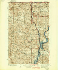
1942 Map of Marcus
USGS Topo · Published 1942About this map
Kettle River and the Columbia River converge in this 1930s-era topographic study, depicting a landscape defined by its mining heritage and riverfront settlements. The Great Northern Railway tracks follow the western bank of the Columbia, linking established communities like Marcus, Bossburg, and Evans before the dramatic changes brought by river development. Numerous mines, including the Kettle River Mine, First Thought Mine, and Big Iron Mine, are scattered across the high country, reflecting the intensive mineral exploration in the Colville National Forest during this period.
Find a feature on this map
131 named features on this map. Tap any name to fly to it.
Don’t see what you’re looking for? This feature index may not catch every label — zoom into the map to look around manually.
Map Details
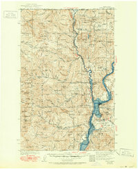
Editions of this 1942 Marcus Map
3 editions found
Other maps of this area

1904 · Republic
USGS Topo · 1:125,000

1927 · Chewelah
USGS Topo · 1:125,000

1929 · Colville
USGS Topo · 1:125,000

1930 · Chewelah
USGS Topo · 1:125,000

1933 · Colville
USGS Topo · 1:125,000

1936 · Marcus
USGS Topo · 1:96,000

1942 · Marcus
USGS Topo · 1:125,000

1948 · Curlew
USGS Topo · 1:62,500

1948 · Republic
USGS Topo · 1:62,500

1948 · Sherman Peak
USGS Topo · 1:62,500