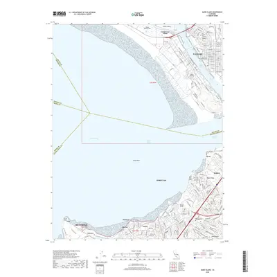
2018 Map of Mare Island
USGS Topo · Published 2018About this map
Vallejo and the heavy industry of the North Bay shoreline dominate this survey, where the Napa River meets the Carquinez Strait. The layout of the Mare Island naval area and the adjacent Mare Island Strait remains a central geographic feature, connected to the mainland by the Napa River Bridge. To the south, the industrial corridor continues through Oleum, Nitro, and Hercules, tracing a dense network of transit and processing sites along the San Pablo Bay.
Find a feature on this map
165 named features on this map. Tap any name to fly to it.
Don’t see what you’re looking for? This feature index may not catch every label — zoom into the map to look around manually.
Map Details
Editions of this 2018 Mare Island Map
This is the sole edition of this map. No revisions or reprints were ever made.
Other maps of this area

1895 · San Francisco
USGS Topo · 1:62,500

1896 · Carquinez Strait
USGS Topo · 1:62,500

1897 · Concord
USGS Topo · 1:62,500

1898 · Karquines
USGS Topo · 1:62,500

1899 · San Francisco
USGS Topo · 1:62,500

1901 · Karquines
USGS Topo · 1:62,500

1902 · Napa
USGS Topo · 1:125,000

1915 · Concord
USGS Topo · 1:62,500

1915 · San Francisco
USGS Topo · 1:62,500

1916 · Mare Island
USGS Topo · 1:62,500