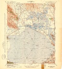
1942 Map of Mare Island
USGS Topo · Published 1942About this map
San Pablo Bay anchors this complex intersection of waterways and industrial corridors during the early years of the Second World War. The topography is dominated by the Mare Island naval facility and the growing urban center of Vallejo, which served as a critical hub for maritime logistics. The shoreline is a dense network of tidal sloughs, including Napa River and Sonoma Creek, winding between reclaimed marshlands such as Tubbs Island and Edgerley Island.
Find a feature on this map
87 named features on this map. Tap any name to fly to it.
Don’t see what you’re looking for? This feature index may not catch every label — zoom into the map to look around manually.
Map Details
Editions of this 1942 Mare Island Map
This is the sole edition of this map. No revisions or reprints were ever made.
Other maps of this area

1895 · San Francisco
USGS Topo · 1:62,500

1896 · Carquinez Strait
USGS Topo · 1:62,500

1897 · Concord
USGS Topo · 1:62,500

1897 · Tamalpais
USGS Topo · 1:62,500

1898 · Karquines
USGS Topo · 1:62,500

1899 · San Francisco
USGS Topo · 1:62,500
1901 · Karquines
USGS Topo · 1:62,500

1902 · Napa
USGS Topo · 1:125,000
1914 · Petaluma
USGS Topo · 1:62,500
1915 · Concord
USGS Topo · 1:62,500