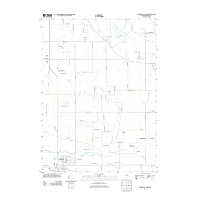
2012 Map of Marengo North
USGS Topo · Published 2012About this map
Agricultural operations and family orchards dominate the landscape north of Marengo, Illinois, at the beginning of the 2010s. This survey of the Kishwaukee River basin reveals an area deeply rooted in specialized farming, including Prairie Sky Orchard, Lang's Orchard, and Woodstock Country Orchard, alongside the production facilities of Central Sod Farms. The geography is defined by the winding course of the N Br Kishwaukee River and its sister branches, which cut through the township grid between the established settlements of Hartland and Franklinville. Local history is preserved in several small burial grounds such as South Dunham Cem and Pioneer Cem, while the presence of Hunter Airport and Aerogrange Airport indicates a high density of private aviation facilities serving the rural McHenry County community.
Find a feature on this map
93 named features on this map. Tap any name to fly to it.
Don’t see what you’re looking for? This feature index may not catch every label — zoom into the map to look around manually.
Map Details
Editions of this 2012 Marengo North Map
This is the sole edition of this map. No revisions or reprints were ever made.
Other maps of this area

1925 · Elgin
USGS Topo · 1:62,500

1926 · Mc Henry
USGS Topo · 1:62,500

1932 · Harvard
USGS Topo · 1:48,000

1937 · Harvard
USGS Topo · 1:62,500

1938 · Genoa
USGS Topo · 1:62,500

1940 · Elgin
USGS Topo · 1:62,500

1944 · McHenry
USGS Topo · 1:62,500

1954 · Rockford
USGS Topo · 1:250,000

1955 · Rockford
USGS Topo · 1:250,000

1958 · Rockford
USGS Topo · 1:250,000