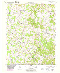
1953 Map of Maretburg
USGS Topo · Published 1979About this map
Wilderness Road and the Louisville and Nashville railroad cut a historical path through this portion of Rockcastle Co, following the natural corridors of the Kentucky landscape. The village of Maretburg serves as a local hub near Double Springs and Owens Spring, while the surrounding hills are marked by numerous small rural institutions. Named knobs like Purcell Knob and McCall Knob punctuate the terrain, overlooking a network of creek-bottom communities such as Ottawa, Quail, and Willailla. The presence of many family-named schools and churches, including Patten Moore Sch and Burnett Ch, indicates a deeply rooted agricultural society. To the south, the deep depressions of Sinking Valley showcase the unique karst topography of the region, where drainage patterns like Brushy Creek and Skegg Creek define the local geography.
Find a feature on this map
65 named features on this map. Tap any name to fly to it.
Don’t see what you’re looking for? This feature index may not catch every label — zoom into the map to look around manually.
Map Details
Editions of this 1953 Maretburg Map
3 editions found
Other maps of this area

1893 · London
USGS Topo · 1:125,000

1897 · London
USGS Topo · 1:125,000

1935 · Somerset
USGS Topo · 1:62,500

1952 · Crab Orchard
USGS Topo · 1:24,000

1952 · Billows
USGS Topo · 1:24,000

1952 · Shopville
USGS Topo · 1:24,000

1952 · Woodstock
USGS Topo · 1:24,000

1953 · Maretburg
USGS Topo · 1:24,000

1953 · Wildie
USGS Topo · 1:24,000
1953 · Brodhead
USGS Topo · 1:24,000