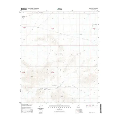
2014 Map of Margies Peak
USGS Topo · Published 2014About this map
Maricopa Mountains dominate this high-desert landscape southwest of Buckeye, where topographic detail reveals the intricate ridges and drainage patterns of the Margies Cove wilderness area. Named peaks like Margies Peak and Sheep Mtn rise sharply from the basin floor, surrounded by a network of seasonal water sources such as Hazen Tank and the CCC tank. The north-central portion of the map transitions into the Little Rainbow Valley, showing the intersection of Bureau of Land Management routes like BLM-8000 with the emerging grid of the regional road network including W Ocotillo Rd and W Riggs Rd. The cartography captures a transition zone between the protected mountain wilderness and the developing rural edges of the Phoenix metropolitan fringe.
Find a feature on this map
19 named features on this map. Tap any name to fly to it.
Don’t see what you’re looking for? This feature index may not catch every label — zoom into the map to look around manually.
Map Details
Editions of this 2014 Margies Peak Map
This is the sole edition of this map. No revisions or reprints were ever made.
Other maps of this area

1946 · Avondale
USGS Topo · 1:62,500

1948 · Cashion
USGS Topo · 1:62,500

1951 · Mobile
USGS Topo · 1:62,500

1951 · Cotton Center
USGS Topo · 1:62,500

1954 · Phoenix
USGS Topo · 1:250,000

1957 · Phoenix
USGS Topo · 1:250,000

1957 · Avondale SW
USGS Topo · 1:24,000

1958 · Phoenix
USGS Topo · 1:250,000

1958 · Hassayampa
USGS Topo · 1:24,000

1958 · Buckeye
USGS Topo · 1:24,000