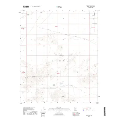
2018 Map of Margies Peak
USGS Topo · Published 2018About this map
Maricopa Mountains and the prominent height of Margies Peak define this desert landscape south of Buckeye. The topography shows a high-desert environment characterized by isolated peaks and seasonal water management, as evidenced by Hazen Tank and CCC tank. This area serves as a significant drainage basin, with Rainbow Wash cutting through the northwestern portion of the map. To the north, the terrain transitions into the Little Rainbow Valley, where the road network begins to emerge with thoroughfares such as Komatke RD and Riggs RD. Notable landmarks like Margies Cove and Sheep Mtn provide essential reference points for navigating the desert floor between the steep, rocky ridges.
Find a feature on this map
25 named features on this map. Tap any name to fly to it.
Don’t see what you’re looking for? This feature index may not catch every label — zoom into the map to look around manually.
Map Details
Editions of this 2018 Margies Peak Map
This is the sole edition of this map. No revisions or reprints were ever made.
Other maps of this area

1946 · Avondale
USGS Topo · 1:62,500

1948 · Cashion
USGS Topo · 1:62,500

1951 · Mobile
USGS Topo · 1:62,500

1951 · Cotton Center
USGS Topo · 1:62,500

1954 · Phoenix
USGS Topo · 1:250,000

1957 · Phoenix
USGS Topo · 1:250,000

1957 · Avondale SW
USGS Topo · 1:24,000

1958 · Phoenix
USGS Topo · 1:250,000

1958 · Hassayampa
USGS Topo · 1:24,000

1958 · Buckeye
USGS Topo · 1:24,000