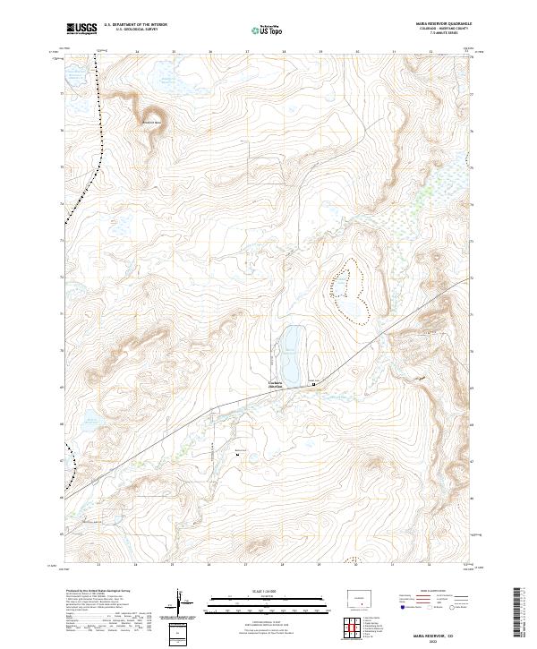
2022 Map of Maria Reservoir
USGS Topo · Published 2022About this map
Cuchara Junction serves as the focal point of this Huerfano County landscape, where the Cucharas River and several arroyos cut through the high plains. The area is defined by an intricate network of water management, visible through the Duran Ditch, Holita Ditch, and Gomez Ditch, which feed various catchments including Maria Reservoir and Holita Reservoir. These features reflect the long-standing agricultural and ranching reliance on seasonal water flows in this arid environment.
Find a feature on this map
28 named features on this map. Tap any name to fly to it.
Don’t see what you’re looking for? This feature index may not catch every label — zoom into the map to look around manually.
Map Details
Editions of this 2022 Maria Reservoir Map
This is the sole edition of this map. No revisions or reprints were ever made.
Other maps of this area

1891 · Walsenburg
USGS Topo · 1:125,000

1894 · Walsenburg
USGS Topo · 1:125,000

1897 · Walsenburg
USGS Topo · 1:125,000

1900 · Walsenburg
USGS Topo · 1:125,000

1954 · Trinidad
USGS Topo · 1:250,000

1955 · Trinidad
USGS Topo · 1:250,000

1958 · Trinidad
USGS Topo · 1:250,000

1959 · Trinidad
USGS Topo · 1:250,000
1963 · Walsenburg South
USGS Topo · 1:24,000
1963 · Walsenburg North
USGS Topo · 1:24,000