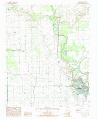
1984 Map of Marianna
USGS Topo · Published 1985About this map
Marianna serves as the regional hub in this mid-1980s look at Lee County, situated where the lowlands are defined by the winding course of the L' Anguille River. The landscape reveals a pattern of rural settlements and small agricultural centers such as Wrightland, Felton, and Canaan. The presence of the Lee Co-Marianna Airport and multiple landing strips suggests the importance of aerial access for the region's expansive farming operations. Hydrology dominates the terrain, with Big Cypress Creek and Larkin Creek draining into the river system, while Three Mile Slough marks the eastern edge of the survey. For those researching family history in the Arkansas Delta, this map records the locations of numerous unnamed rural cemeteries and outlying communities like Westor and Larkin before late-century changes altered the local road and settlement networks.
Find a feature on this map
14 named features on this map. Tap any name to fly to it.
Don’t see what you’re looking for? This feature index may not catch every label — zoom into the map to look around manually.
Map Details
Editions of this 1984 Marianna Map
2 editions found
Other maps of this area

1939 · Park Place
USGS Topo · 1:62,500

1939 · Latour
USGS Topo · 1:62,500

1940 · Marvell
USGS Topo · 1:62,500

1940 · Marianna
USGS Topo · 1:62,500

1948 · Helena
USGS Topo · 1:250,000

1950 · Helena
USGS Topo · 1:250,000

1955 · Park Place
USGS Topo · 1:62,500

1955 · Latour
USGS Topo · 1:62,500

1955 · Helena
USGS Topo · 1:250,000

1956 · Marvell
USGS Topo · 1:62,500