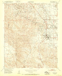
1951 Map of Maricopa
USGS Topo · Published 1951About this map
The petroleum industry at the southern end of the San Joaquin Valley is the defining characteristic of this landscape. The settlement of Maricopa sits at the junction of several arterial roads, surrounded by extensive Oil Wells and industrial infrastructure such as the Norwalk Oil Refinery and the Standard Oil Signa Sta. This 1951 edition highlights the density of the oil fields, where pipelines and sumps cross the terrain toward the Midway Valley.
Find a feature on this map
21 named features on this map. Tap any name to fly to it.
Don’t see what you’re looking for? This feature index may not catch every label — zoom into the map to look around manually.
Map Details
Editions of this 1951 Maricopa Map
This is the sole edition of this map. No revisions or reprints were ever made.
Other maps of this area

1902 · Santa Ynez
USGS Topo · 1:125,000

1903 · Mt. Pinos
USGS Topo · 1:125,000

1905 · Santa Ynez
USGS Topo · 1:125,000

1910 · Buena Vista Lake
USGS Topo · 1:125,000

1912 · McKittrick
USGS Topo · 1:125,000

1912 · Buena Vista Lake
USGS Topo · 1:125,000

1929 · Mouth of Kern
USGS Topo · 1:31,680

1931 · Pentland Junction
USGS Topo · 1:31,680

1932 · Mouth of Kern
USGS Topo · 1:31,680

1934 · Pentland
USGS Topo · 1:31,680