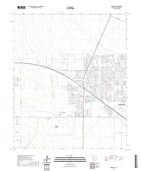
2021 Map of Maricopa
USGS Topo · Published 2021About this map
The growing city of Maricopa serves as a focal point for the northern Pinal County desert, characterized by its rapid residential expansion and proximity to tribal lands. The map documents the intricate street networks of new developments like Rancho El-Dorado Pkwy and Desert Fairways Dr, which contrast with the open expanses of the Ak-Chin Indian Community. Ak-Chin Village and the smaller Ak Chin settlement occupy the western portions of the quadrangle, where the landscape is naturally defined by the meandering courses of the Santa Rosa Wash and Vekol Wash. Educational infrastructure is anchored by the Central Arizona College campus on the eastern edge of the city. The road network, including historic thoroughfares like Maricopa Rd and Bapchule Rd, illustrates the intersection of modern suburban planning with older rural desert routes.
Find a feature on this map
112 named features on this map. Tap any name to fly to it.
Don’t see what you’re looking for? This feature index may not catch every label — zoom into the map to look around manually.
Map Details
Editions of this 2021 Maricopa Map
This is the sole edition of this map. No revisions or reprints were ever made.
Other maps of this area

1913 · Maricopa
USGS Topo · 1:62,500

1914 · Gila Butte
USGS Topo · 1:62,500

1915 · Maricopa
USGS Topo · 1:62,500

1917 · Gila Butte
USGS Topo · 1:62,500

1922 · Casa Grande
USGS Topo · 1:62,500

1924 · Casa Grande
USGS Topo · 1:62,500

1946 · Antelope Peak
USGS Topo · 1:62,500

1948 · Antelope Peak
USGS Topo · 1:62,500

1952 · Maricopa
USGS Topo · 1:24,000

1952 · Sacaton Butte
USGS Topo · 1:24,000