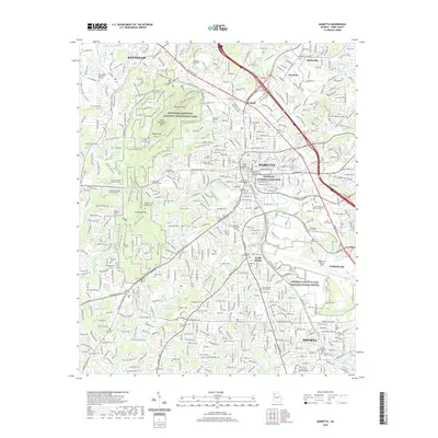
2020 Map of Marietta
USGS Topo · Published 2020About this map
The suburban landscape of Marietta and northern Cobb County is defined by its deep Civil War heritage and modern military presence. Kennesaw Mountain National Battlefield Park preserves a vast swath of terrain including Pigeon Hill and Cheatham Hill, where the 24 Gun Segment (2012) and Camp Brumby Trail mark historic troop movements. In the heart of Marietta, the Cobb County State Courthouse sits near the Marietta National Cemetery and the Marietta Confederate Cem, reflecting the area's dual role as a county seat and a site of significant commemoration.
Find a feature on this map
96 named features on this map. Tap any name to fly to it.
Don’t see what you’re looking for? This feature index may not catch every label — zoom into the map to look around manually.
Map Details
Editions of this 2020 Marietta Map
This is the sole edition of this map. No revisions or reprints were ever made.
Other maps of this area

1888 · Atlanta
USGS Topo · 1:125,000

1890 · Suwanee
USGS Topo · 1:125,000

1890 · Cartersville
USGS Topo · 1:125,000

1890 · Atlanta
USGS Topo · 1:125,000

1891 · Marietta
USGS Topo · 1:125,000

1891 · Cartersville
USGS Topo · 1:125,000

1892 · Atlanta
USGS Topo · 1:125,000

1894 · Suwanee
USGS Topo · 1:125,000

1895 · Atlanta
USGS Topo · 1:125,000

1895 · Marietta
USGS Topo · 1:125,000