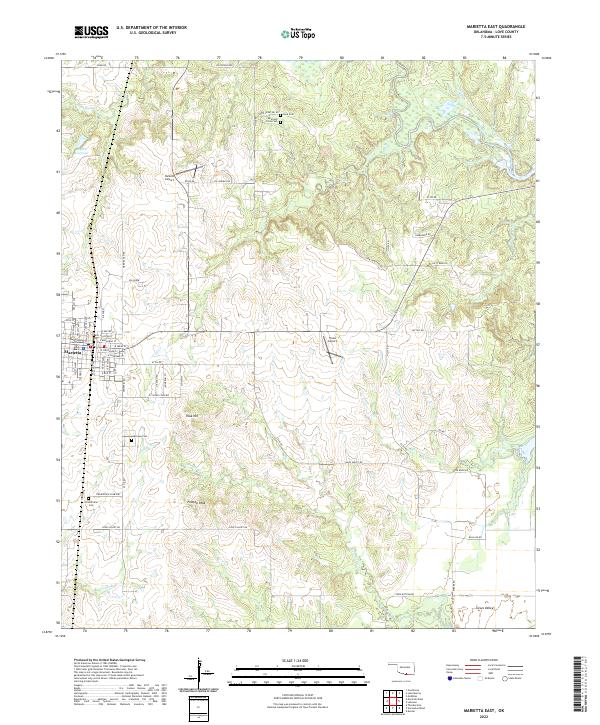
2022 Map of Marietta East
USGS Topo · Published 2022About this map
The Love County Courthouse stands as the central landmark of Marietta, where a grid of streets like Bill Halstied St and E Chickasaw St meets the rural landscape of Love County. The topography is defined by the drainages of Hickory Creek and Thomas Cr, which carve through a terrain punctuated by elevations such as Peak Hill and Flattop Peak. This area in southern Oklahoma preserves several historic burial sites, including the Reid and Cross Cem and Lakeview Cem, alongside the small settlement of Loves Valley near the southern margin. The presence of both Hankins Airport and Travis Airport indicates the regional importance of general aviation for this community. From the T23018 Reservoir to the winding course of Shiggin Cr, the map documents a mix of agricultural utility and established civic infrastructure.
Find a feature on this map
53 named features on this map. Tap any name to fly to it.
Don’t see what you’re looking for? This feature index may not catch every label — zoom into the map to look around manually.
Map Details
Editions of this 2022 Marietta East Map
This is the sole edition of this map. No revisions or reprints were ever made.
Other maps of this area

1901 · Tishomingo
USGS Topo · 1:125,000

1901 · Ardmore
USGS Topo · 1:125,000

1901 · Denison
USGS Topo · 1:125,000

1902 · Gainesville
USGS Topo · 1:125,000

1918 · Ardmore
USGS Topo · 1:125,000

1943 · Gainesville
USGS Topo · 1:125,000

1954 · Sherman
USGS Topo · 1:250,000

1957 · Ardmore
USGS Topo · 1:250,000

1958 · Gordonville
USGS Topo · 1:62,500

1958 · Sherman
USGS Topo · 1:250,000