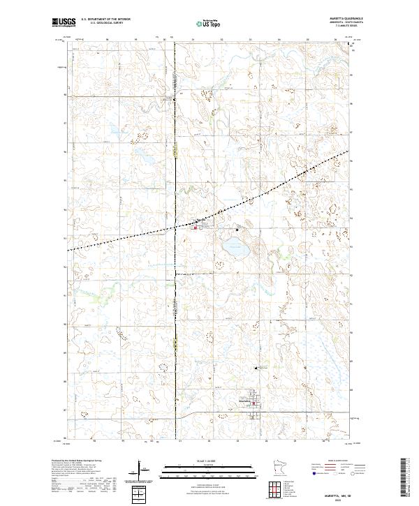
2022 Map of Marietta
USGS Topo · Published 2022About this map
Marietta and Nassau anchor this rural landscape along the Minnesota and South Dakota border, where a grid of township roads organizes the fertile prairie. The S Fork Yellow Bank River and its tributaries, including Mud Cr, weave through the terrain, punctuated by significant water bodies such as Kaufman Slough and Pegg Lake. For those tracing local history or family roots, several established burial grounds are clearly marked, including the Swedish Mission Cem to the north and the Augusta Cem and Saint James Cem situated near the primary settlements. This area is defined by its agricultural character and the precise boundary line separating Lac qui Parle Co from its neighbors in South Dakota.
Find a feature on this map
40 named features on this map. Tap any name to fly to it.
Don’t see what you’re looking for? This feature index may not catch every label — zoom into the map to look around manually.
Map Details
Editions of this 2022 Marietta Map
This is the sole edition of this map. No revisions or reprints were ever made.
Other maps of this area

1953 · Bellingham
USGS Topo · 1:62,500

1953 · Milbank
USGS Topo · 1:250,000

1953 · Watertown
USGS Topo · 1:250,000

1958 · Milbank
USGS Topo · 1:250,000

1958 · Watertown
USGS Topo · 1:250,000

1967 · Gary NW
USGS Topo · 1:24,000
1967 · Mount Wickham
USGS Topo · 1:24,000

1971 · Marietta
USGS Topo · 1:24,000
1971 · Haydenville
USGS Topo · 1:24,000
1971 · Bellingham
USGS Topo · 1:24,000