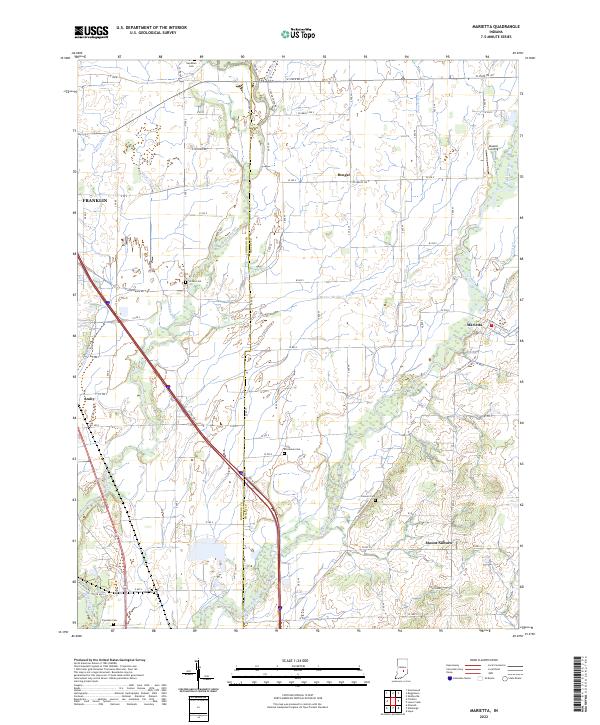
2022 Map of Marietta
USGS Topo · Published 2022About this map
Big Blue River and Sugar Creek dominate this central Indiana landscape along the Johnson and Shelby County line. The terrain is defined by an extensive network of drainage ditches, including Gibson Ditch, Amity Ditch, and McCue-Medsker Ditch, which support the agricultural productivity of the surrounding flats. Small rural clusters like Marietta, Bengal, and Amity serve as local anchors, while the presence of Skeeter Landing suggests the river's historical role in recreation or transport. Genealogists will find significant value in the distribution of family-named burial grounds across the townships, such as Needham Cem in the north and Freeman Cem in the south. The intersection of W State Rd 44 and various county roads provides a clear view of the modern rural infrastructure imposed over the original sectional grid of t12n r5e and t11n r6e.
Find a feature on this map
62 named features on this map. Tap any name to fly to it.
Don’t see what you’re looking for? This feature index may not catch every label — zoom into the map to look around manually.
Map Details
Editions of this 2022 Marietta Map
This is the sole edition of this map. No revisions or reprints were ever made.
Other maps of this area

1942 · Franklin
USGS Topo · 1:125,000

1942 · Columbus
USGS Topo · 1:125,000

1947 · Franklin
USGS Topo · 1:62,500

1947 · Hope
USGS Topo · 1:24,000

1948 · Franklin
USGS Topo · 1:24,000

1948 · Edinburg
USGS Topo · 1:24,000

1948 · Hope
USGS Topo · 1:24,000

1948 · Nineveh
USGS Topo · 1:24,000

1948 · Lewis Creek
USGS Topo · 1:24,000

1948 · Marietta
USGS Topo · 1:24,000