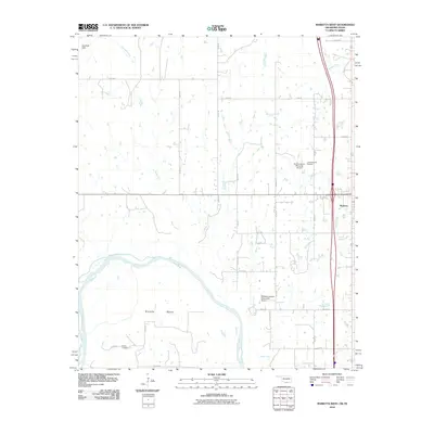
2010 Map of Marietta West
USGS Topo · Published 2010About this map
The Red River snakes through the southern portion of this landscape, forming the natural boundary between Oklahoma and Texas. On the northern banks, the terrain is defined by the Eastman Hills and a network of drainages including Rock Creek and Walnut Bayou. This 2010 survey highlights a corridor of aviation and infrastructure, featuring the W G Anderson Memorial Airport, Love County Airport, and the uniquely named McGehee Catfish Restaurant Airport. The city of Marietta sits on the eastern edge, while the smaller settlement of Sivells Bend is positioned near a prominent loop in the river. Local genealogy is represented by the Gunter Cemetery in the southwest, situated among a grid of rural routes like Dixon Rd and Martin Ln. The map illustrates the transition from the upland hills to the fertile bottomlands of the river valley.
Find a feature on this map
33 named features on this map. Tap any name to fly to it.
Don’t see what you’re looking for? This feature index may not catch every label — zoom into the map to look around manually.
Map Details
Editions of this 2010 Marietta West Map
This is the sole edition of this map. No revisions or reprints were ever made.
Other maps of this area

1901 · Ardmore
USGS Topo · 1:125,000

1902 · Gainesville
USGS Topo · 1:125,000

1918 · Ardmore
USGS Topo · 1:125,000

1943 · Gainesville
USGS Topo · 1:125,000

1954 · Sherman
USGS Topo · 1:250,000

1957 · Ardmore
USGS Topo · 1:250,000

1958 · Sherman
USGS Topo · 1:250,000

1963 · Ardmore
USGS Topo · 1:250,000

1964 · Lake Murray
USGS Topo · 1:24,000

1964 · Overbrook
USGS Topo · 1:24,000