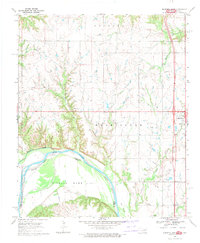
1968 Map of Marietta West
USGS Topo · Published 1971About this map
Red River meanders across this borderlands landscape, defining the state boundary between Oklahoma and Texas. On the northern banks in Love County, the town of Marietta serves as a hub of activity, featuring its own Athletic Field, Sewage Disposal, and electrical Substation. The map reveals a rural network of social and religious centers such as Bowles Ch and Shadydale Ch, alongside the Gunter Cem south of the river in the Sivells Bend region. Land surveying history is visible through the prominent Indian Meridian running north-south through the western portion of the quadrangle. Waterways like Walnut Bayou, Rock Creek, and Bills Creek dissect the terrain, which is also crisscrossed by several industrial pipelines and dotted with local resource extraction sites like the various Gravel Pits found along the creek beds.
Find a feature on this map
27 named features on this map. Tap any name to fly to it.
Don’t see what you’re looking for? This feature index may not catch every label — zoom into the map to look around manually.
Map Details
Editions of this 1968 Marietta West Map
This is the sole edition of this map. No revisions or reprints were ever made.
Other maps of this area

1901 · Ardmore
USGS Topo · 1:125,000

1902 · Gainesville
USGS Topo · 1:125,000

1918 · Ardmore
USGS Topo · 1:125,000

1943 · Gainesville
USGS Topo · 1:125,000

1954 · Sherman
USGS Topo · 1:250,000

1957 · Ardmore
USGS Topo · 1:250,000

1958 · Sherman
USGS Topo · 1:250,000

1963 · Ardmore
USGS Topo · 1:250,000

1964 · Lake Murray
USGS Topo · 1:24,000

1964 · Overbrook
USGS Topo · 1:24,000