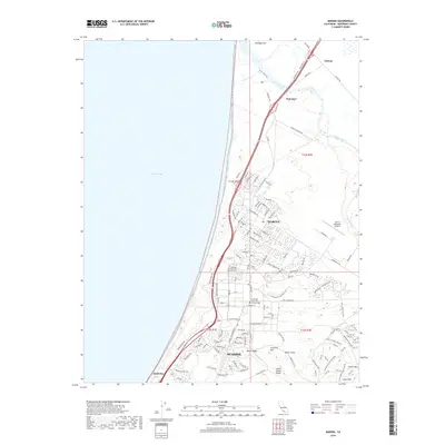
2018 Map of Marina
USGS Topo · Published 2018About this map
The coastal interface of Monterey Bay and the mouth of the Salinas River anchor this topographic survey of the Monterey coastline. The transition from the sandy shoreline of Sand City and Marina into the undulating terrain of the interior is marked by several named ridges and elevations, including Mulligan Hill, Artillery Hill, and Welch Ridge. The landscape reflects a mix of civic expansion and dedicated federal land use, notably the campus of California State Univ-Monterey Bay and the California Central Coast Veterans Cem.
Find a feature on this map
133 named features on this map. Tap any name to fly to it.
Don’t see what you’re looking for? This feature index may not catch every label — zoom into the map to look around manually.
Map Details
Editions of this 2018 Marina Map
This is the sole edition of this map. No revisions or reprints were ever made.
Other maps of this area

1910 · Salinas
USGS Topo · 1:31,680

1912 · Salinas
USGS Topo · 1:62,500

1912 · Capitola
USGS Topo · 1:62,500

1913 · Monterey
USGS Topo · 1:62,500

1914 · Capitola
USGS Topo · 1:62,500

1915 · San Juan Bautista
USGS Topo · 1:48,000

1917 · San Juan Bautista
USGS Topo · 1:62,500

1939 · San Juan Bautista
USGS Topo · 1:62,500

1940 · San Juan Bautista
USGS Topo · 1:62,500

1940 · Salinas
USGS Topo · 1:62,500