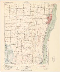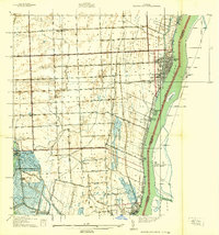
1939 Map of Marine City
USGS Topo · Published 1939About this map
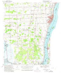
The St Clair River corridor in the late 1930s is a landscape defined by its deep maritime and agricultural roots, spanning from the bustling docks of Marine City down to Algonac. The interior is dotted with one-room schoolhouses like Maple Crest Sch and Diem Sch, spaced for rural families, while the Port Huron and Detroit Railroad traces the shoreline, supporting the region's transport economy. Near Roberts Landing, the connection between the American shore and the Canadian settlements of Sombra and Port Lambton is clearly visible across the international boundary.
Find a feature on this map
84 named features on this map. Tap any name to fly to it.
Don’t see what you’re looking for? This feature index may not catch every label — zoom into the map to look around manually.
Map Details
Editions of this 1939 Marine City Map
This is the sole edition of this map. No revisions or reprints were ever made.
Historical Maps of Clay Township Through Time
8 maps found