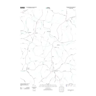
2013 Map of Marion Center
USGS Topo · Published 2013About this map
Marion Center serves as the primary hub in this corner of northern Indiana County, where the landscape is defined by the winding course of Little Mahoning Cr and its many tributaries. The area maintains a distinct rural character, with small settlements like Mottarns Mill, Georgeville, and Marchand connected by a network of secondary roads and Us-119. To the west, Mahoning Creek Lake marks the edge of the quadrangle near the community of McCormick. Local aviation and recreation are represented by the Marion Center Speedway Airport located near Oak Tree. The map detail captures a complex drainage system including Ross Run, Pickering Run, and S Br Plum Cr, which shaped the early development of these small Pennsylvania hamlets and their surrounding farmsteads.
Find a feature on this map
106 named features on this map. Tap any name to fly to it.
Don’t see what you’re looking for? This feature index may not catch every label — zoom into the map to look around manually.
Map Details
Editions of this 2013 Marion Center Map
This is the sole edition of this map. No revisions or reprints were ever made.
Other maps of this area

1902 · Indiana
USGS Topo · 1:62,500

1902 · Barnesboro
USGS Topo · 1:62,500

1904 · Barnesboro
USGS Topo · 1:62,500

1906 · Punxsutawney
USGS Topo · 1:62,500

1909 · Smicksburg
USGS Topo · 1:62,500

1938 · Smicksburg
USGS Topo · 1:62,500

1939 · Smicksburg
USGS Topo · 1:62,500

1939 · Punxsutawney
USGS Topo · 1:62,500

1942 · Punxsutawney
USGS Topo · 1:62,500

1943 · Punxsutawney
USGS Topo · 1:125,000
Featured Places
- Rayne Township, PA
- South Mahoning Township, PA
- Barton, East Mahoning Township
- Georgeville, East Mahoning Township
- Marchand, North Mahoning Township