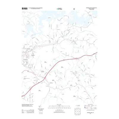
2013 Map of Marion East
USGS Topo · Published 2013About this map
Lake James dominates the northern landscape of this McDowell County region, where the reservoir's complex shoreline creates numerous inlets and the prominent Big Island. Along the southern and western margins, the settlements of Clinchfield, Stumptown, and East Marion reveal the suburban and industrial expansion of the era, while Nebo remains a central focal point near Shadrick Cr. The terrain is defined by a series of significant peaks, including Gibbs Mountain and Smith Mountain, which separate the various drainage basins of the N Fork Catawba River and N Muddy Cr. Notable institutional land use is evident at the North Carolina State Prison Camp located near the base of Jamison Mountain. The map illustrates a transition between the lakeside recreation of Lake James State Park and the rugged residential developments tucked into the Piedmont foothills.
Find a feature on this map
228 named features on this map. Tap any name to fly to it.
Don’t see what you’re looking for? This feature index may not catch every label — zoom into the map to look around manually.
Map Details
Editions of this 2013 Marion East Map
This is the sole edition of this map. No revisions or reprints were ever made.
Other maps of this area

1900 · Mount Mitchell
USGS Topo · 1:125,000

1902 · Mount Mitchell
USGS Topo · 1:125,000

1905 · Morganton
USGS Topo · 1:125,000

1953 · Charlotte
USGS Topo · 1:250,000

1954 · Charlotte
USGS Topo · 1:250,000

1955 · Knoxville
USGS Topo · 1:250,000

1956 · Oak Hill
USGS Topo · 1:24,000

1956 · Ashford
USGS Topo · 1:24,000

1956 · Linville Falls
USGS Topo · 1:62,500

1957 · Knoxville
USGS Topo · 1:250,000