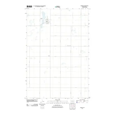
2011 Map of Marion
USGS Topo · Published 2011About this map
Marion sits as the central hub of this LaMoure County landscape, where the town grid is defined by Main St and a series of numbered avenues like 2nd Ave and 3rd Ave. The surrounding prairie is methodically partitioned by a network of rural roads, including 99th Ave SE and 60th St SE, which track across a terrain dotted with small water bodies and seasonal wetlands. Genealogists and local historians will find several key burial sites preserved here, from Lake View Cemetery on the northern edge of the settlement to the more isolated Saint Johns Cemetery and Grace Cemetery further south and east. The map reflects a long-established agricultural grid where County Rd 61 and County Rd 35 serve as the primary conduits for local transport, connecting the clustered homes of the town to the expansive fields of the northern plains.
Find a feature on this map
25 named features on this map. Tap any name to fly to it.
Don’t see what you’re looking for? This feature index may not catch every label — zoom into the map to look around manually.
Map Details
Editions of this 2011 Marion Map
This is the sole edition of this map. No revisions or reprints were ever made.
Other maps of this area

1894 · La Moure
USGS Topo · 1:62,500

1895 · Lamoure
USGS Topo · 1:125,000

1897 · Eckelson
USGS Topo · 1:125,000

1918 · La Moure
USGS Topo · 1:125,000

1952 · Dickey
USGS Topo · 1:24,000

1952 · Grand Rapids
USGS Topo · 1:24,000

1953 · Jamestown
USGS Topo · 1:250,000

1956 · Jamestown
USGS Topo · 1:250,000
1956 · Berlin
USGS Topo · 1:24,000

1970 · Litchville
USGS Topo · 1:24,000