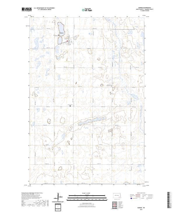
2024 Map of Marion
USGS Topo · Published 2024About this map
Marion serves as the focal point of this LaMoure County landscape, situated amidst a dense network of wetlands and prairie potholes. The settlement's street grid is clearly defined, featuring Center St, Main Ave, and 3rd Main St as its primary thoroughfares. For those tracing local heritage, the map identifies three distinct burial sites: Lakeview Cem on the northern edge of town, Emmanuel Cem to the south, and Saint John's Lutheran Cem farther east. The surrounding township is defined by the LaMoure County Waterfowl Production Area, which occupies several sections of the eastern half. The survey illustrates a terrain dominated by water conservation and agricultural boundaries, with an intricate system of section roads like 55th St SE and 100th Ave SE providing access to the various wetlands and production zones.
Find a feature on this map
28 named features on this map. Tap any name to fly to it.
Don’t see what you’re looking for? This feature index may not catch every label — zoom into the map to look around manually.
Map Details
Editions of this 2024 Marion Map
This is the sole edition of this map. No revisions or reprints were ever made.
Other maps of this area

1894 · La Moure
USGS Topo · 1:62,500

1895 · Lamoure
USGS Topo · 1:125,000

1897 · Eckelson
USGS Topo · 1:125,000

1918 · La Moure
USGS Topo · 1:125,000

1952 · Dickey
USGS Topo · 1:24,000

1952 · Grand Rapids
USGS Topo · 1:24,000

1953 · Jamestown
USGS Topo · 1:250,000

1956 · Jamestown
USGS Topo · 1:250,000
1956 · Berlin
USGS Topo · 1:24,000

1970 · Litchville
USGS Topo · 1:24,000