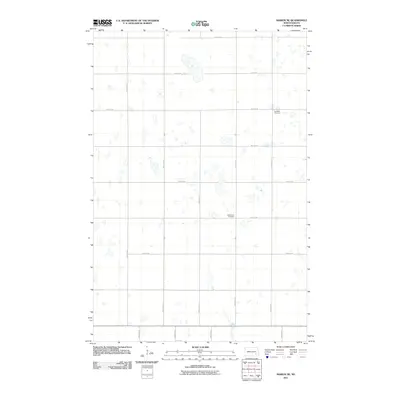
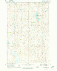
2011 Map of Marion NE
USGS Topo · Published 2011About this map
The prairie landscape of Barnes County, North Dakota, is defined by its rectilinear grid of section roads and numerous small depressions and sloughs. Settled patterns in this region of Meadow Lake Township are reflected primarily in the local burial grounds, including the Swedish Cemetery and Bethlehem Cemetery, which serve as quiet markers of the community's ancestral heritage. A network of arterial routes like County Rd 61 and a series of numbered avenues, such as 100th Ave SE and 104th Ave SE, segment the agricultural terrain. This 2011 survey captures the area’s distinct hydrography, where the distribution of water bodies across the plains dictates the placement of farmsteads and transport corridors like 48th St SE.
Find a feature on this map
16 named features on this map. Tap any name to fly to it.
Don’t see what you’re looking for? This feature index may not catch every label — zoom into the map to look around manually.
Map Details
Editions of this 2011 Marion NE Map
This is the sole edition of this map. No revisions or reprints were ever made.
Other maps of this area

1897 · Eckelson
USGS Topo · 1:125,000

1952 · Dickey
USGS Topo · 1:24,000

1953 · Jamestown
USGS Topo · 1:250,000

1956 · Jamestown
USGS Topo · 1:250,000

1970 · Litchville
USGS Topo · 1:24,000
1970 · Litchville SW
USGS Topo · 1:24,000
1970 · Moon Lake
USGS Topo · 1:24,000

1970 · Marion NE
USGS Topo · 1:24,000
1970 · Marion NW
USGS Topo · 1:24,000
1970 · Eckelson SE
USGS Topo · 1:24,000
Featured Places
- Meadow Lake Township, ND
- Svea Township, ND
- Rosebud Township, ND
- Greenland Township, ND
- Prairie Township, ND