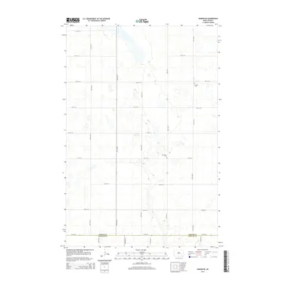
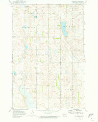
2014 Map of Marion NE
USGS Topo · Published 2014About this map
Glacial potholes and prairie wetlands define the rural landscape along the boundary of Barnes Co and Lamoure Co. This 2014 survey records a sparsely populated agricultural region characterized by a high density of small water bodies and a strictly regulated grid of section-line roads, including 100th Ave SE and 48th St SE. For genealogists, the map identifies two small burial grounds that serve as the primary landmarks of local settlement: Swedish Cem in the northeastern quadrant and Bethlehem Cem further south. These sites, often associated with early immigrant communities, remain as the remaining physical anchors in a territory dominated by open fields and seasonal wetlands.
Find a feature on this map
18 named features on this map. Tap any name to fly to it.
Don’t see what you’re looking for? This feature index may not catch every label — zoom into the map to look around manually.
Map Details
Editions of this 2014 Marion NE Map
This is the sole edition of this map. No revisions or reprints were ever made.
Other maps of this area

1897 · Eckelson
USGS Topo · 1:125,000

1952 · Dickey
USGS Topo · 1:24,000

1953 · Jamestown
USGS Topo · 1:250,000

1956 · Jamestown
USGS Topo · 1:250,000

1970 · Litchville
USGS Topo · 1:24,000
1970 · Litchville SW
USGS Topo · 1:24,000
1970 · Moon Lake
USGS Topo · 1:24,000

1970 · Marion NE
USGS Topo · 1:24,000
1970 · Marion NW
USGS Topo · 1:24,000
1970 · Eckelson SE
USGS Topo · 1:24,000
Featured Places
- Meadow Lake Township, ND
- Svea Township, ND
- Rosebud Township, ND
- Greenland Township, ND
- Prairie Township, ND