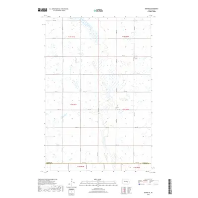
2018 Map of Marion NE
USGS Topo · Published 2018About this map
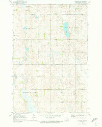
Glacial depressions and small prairie wetlands dominate this portion of the North Dakota plains, where the rectilinear grid of section roads defines a landscape of agricultural utility. The boundary between Barnes Co and LaMoure Co runs along 54th St SE, marking the southern extent of the survey. The region is largely defined by the Public Land Survey System, with townships like t137n r60w and t138n r61w containing the small markers of early community life. Scattered burial sites, including the Swedish Cem in the northeast and Bethlehem Cem further south near 102nd Ave SE, serve as primary genealogical anchors for the area. The map illustrates a contemporary view of this rural landscape, highlighting how the 19th-century township divisions continue to organize the road networks and property lines of the modern prairie.
Find a feature on this map
24 named features on this map. Tap any name to fly to it.
Don’t see what you’re looking for? This feature index may not catch every label — zoom into the map to look around manually.
Map Details
Editions of this 2018 Marion NE Map
This is the sole edition of this map. No revisions or reprints were ever made.
Other maps of this area

1897 · Eckelson
USGS Topo · 1:125,000

1952 · Dickey
USGS Topo · 1:24,000

1953 · Jamestown
USGS Topo · 1:250,000

1956 · Jamestown
USGS Topo · 1:250,000

1970 · Litchville
USGS Topo · 1:24,000
1970 · Litchville SW
USGS Topo · 1:24,000
1970 · Moon Lake
USGS Topo · 1:24,000

1970 · Marion NE
USGS Topo · 1:24,000
1970 · Marion NW
USGS Topo · 1:24,000
1970 · Eckelson SE
USGS Topo · 1:24,000
Featured Places
- Meadow Lake Township, ND
- Svea Township, ND
- Rosebud Township, ND
- Greenland Township, ND
- Prairie Township, ND