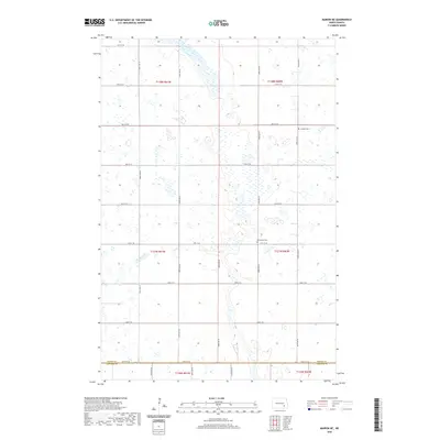
2020 Map of Marion NE
USGS Topo · Published 2020About this map
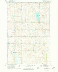
Glacial prairie potholes and seasonal wetlands define this section of the North Dakota plains, where the Barnes Co and Lamoure Co line runs along 54th St SE. The landscape is a testament to the Public Land Survey System, with a rigid grid of section-line roads like 102nd Ave SE and 49th St SE carving through the terrain. Two local landmarks of genealogical importance, Bethlehem Cem and Swedish Cem, stand as the primary evidence of the community’s early 20th-century heritage. These sites are the anchors of a landscape otherwise dominated by expansive agricultural plots and a complex network of small, scattered water bodies that characterize the region's unique hydrology.
Find a feature on this map
24 named features on this map. Tap any name to fly to it.
Don’t see what you’re looking for? This feature index may not catch every label — zoom into the map to look around manually.
Map Details
Editions of this 2020 Marion NE Map
This is the sole edition of this map. No revisions or reprints were ever made.
Other maps of this area

1897 · Eckelson
USGS Topo · 1:125,000

1952 · Dickey
USGS Topo · 1:24,000

1953 · Jamestown
USGS Topo · 1:250,000

1956 · Jamestown
USGS Topo · 1:250,000

1970 · Litchville
USGS Topo · 1:24,000
1970 · Litchville SW
USGS Topo · 1:24,000
1970 · Moon Lake
USGS Topo · 1:24,000

1970 · Marion NE
USGS Topo · 1:24,000
1970 · Marion NW
USGS Topo · 1:24,000
1970 · Eckelson SE
USGS Topo · 1:24,000
Featured Places
- Meadow Lake Township, ND
- Svea Township, ND
- Rosebud Township, ND
- Greenland Township, ND
- Prairie Township, ND