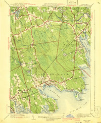
1941 Map of Marion
USGS Topo · Published 1941About this map
The coastal communities of Mattapoisett and Marion dominate this survey, situated along the intricately carved shoreline of Buzzards Bay. The landscape is a mosaic of dense wetlands like Bear Swamp and Haskell Swamp interspersed with agricultural ventures such as Sippican Bog. Inland, the village of Rochester serves as a hub for local transit, while the New York New Haven and Hartford railroad provides a vital link through Marion Sta.
Find a feature on this map
85 named features on this map. Tap any name to fly to it.
Don’t see what you’re looking for? This feature index may not catch every label — zoom into the map to look around manually.
Map Details
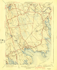
Editions of this 1941 Marion Map
3 editions found

Other maps of this area

1885 · New Bedford
USGS Topo · 1:62,500

1885 · Middleboro
USGS Topo · 1:62,500

1886 · Falmouth
USGS Topo · 1:62,500

1886 · Plymouth
USGS Topo · 1:62,500

1888 · New Bedford
USGS Topo · 1:62,500

1888 · Falmouth
USGS Topo · 1:62,500

1888 · Middleboro
USGS Topo · 1:62,500

1889 · Plymouth
USGS Topo · 1:62,500

1893 · Middleboro
USGS Topo · 1:62,500

1893 · Falmouth
USGS Topo · 1:62,500