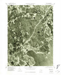
1977 Map of Marion
USGS Topo · Published 1981About this map
Mattapoisett and its surrounding harbor areas appear in high detail during the late 1970s, showcasing the coastal development along the northern shores of Buzzards Bay. This orthophotoquad, derived from aerial photography, provides a literal view of the landscape where the Mattapoisett River and Sipplican River meet the Atlantic. The image records the transition from the dense woodlands of Rochester to the residential and maritime reaches of Marion and Harbor Beach. Researchers can observe the mid-century footprint of coastal infrastructure and the varied terrain of Sconticut Neck near East Fairhaven. Unlike traditional topographic maps, this photographic survey preserves the exact tree lines, field boundaries, and road layouts as they existed on the ground, offering an unfiltered look at the South Shore's physical geography before later modern expansion.
Find a feature on this map
9 named features on this map. Tap any name to fly to it.
Don’t see what you’re looking for? This feature index may not catch every label — zoom into the map to look around manually.
Map Details
Editions of this 1977 Marion Map
4 editions found
Other maps of this area

1885 · New Bedford
USGS Topo · 1:62,500

1885 · Middleboro
USGS Topo · 1:62,500

1886 · Falmouth
USGS Topo · 1:62,500

1886 · Plymouth
USGS Topo · 1:62,500

1888 · New Bedford
USGS Topo · 1:62,500

1888 · Falmouth
USGS Topo · 1:62,500

1888 · Middleboro
USGS Topo · 1:62,500

1889 · Plymouth
USGS Topo · 1:62,500

1893 · Middleboro
USGS Topo · 1:62,500

1893 · Falmouth
USGS Topo · 1:62,500