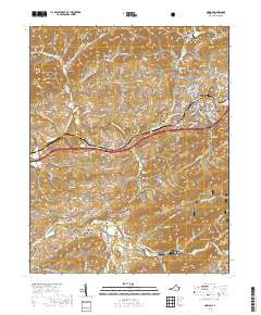
2019 Map of Marion
USGS Topo · Published 2019About this map
The town of Marion serves as the focal point of this southwestern Virginia survey, centered on the Smyth County Courthouse and the surrounding street grid including W Chilhowie St and E Main St. The landscape is defined by the parallel ridges of Walker Mtn and Brushy Mtn to the north, and the deep reaches of the Jefferson National Forest to the south. The dual drainage systems of the Middle Fork Holston River and South Fork Holston River carve out distinct valleys such as Wassum Valley and Old Chilhowie Valley. This 2019 survey documents the enduring infrastructure of the Norfolk Southern rail line and Interstate 81, which parallel the older river-and-road routes that once linked the historic settlements of McMullin, Adwolf, and Holston Mill. Small family and community burying grounds like Allen Cem and South Fork Cem are found throughout the hollows.
Find a feature on this map
177 named features on this map. Tap any name to fly to it.
Don’t see what you’re looking for? This feature index may not catch every label — zoom into the map to look around manually.
Map Details
Editions of this 2019 Marion Map
This is the sole edition of this map. No revisions or reprints were ever made.
Other maps of this area

1889 · Wytheville
USGS Topo · 1:125,000

1891 · Abingdon
USGS Topo · 1:125,000

1892 · Wytheville
USGS Topo · 1:125,000

1894 · Abingdon
USGS Topo · 1:125,000

1909 · Abingdon
USGS Topo · 1:96,000

1911 · Abingdon
USGS Topo · 1:125,000

1931 · Rural Retreat
USGS Topo · 1:48,000
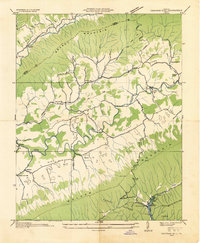
1934 · Chatham Hill
USGS Topo · 1:24,000

1935 · Konnarock
USGS Topo · 1:24,000

1935 · Chilhowie
USGS Topo · 1:24,000