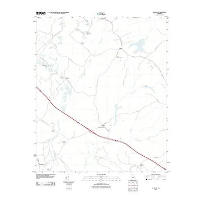
2011 Map of Marion
USGS Topo · Published 2011About this map
Marion and Bullard anchor this portion of Twiggs County, where the landscape is defined by a dense network of family and community burial grounds alongside traditional watercourses. Genealogists will find a wealth of local history through sites such as the Richland Cemetery, Jones-Denson Cemetery, and Linda Melton Late Cemetery. The topography is shaped by numerous tributaries including Turvin Creek, Savage Creek, and Scuffle Creek, which drain toward the larger swampy lowlands of the region. Transportation follows historic corridors like the Old Marion Rd and Old Richland Church Rd, connecting small settlements and farmsteads. Engineered water bodies such as Lanier Lake and Mallory Lake, both featuring labeled dams, point to localized land management and recreation within this rural Georgia landscape.
Find a feature on this map
46 named features on this map. Tap any name to fly to it.
Don’t see what you’re looking for? This feature index may not catch every label — zoom into the map to look around manually.
Map Details
Editions of this 2011 Marion Map
This is the sole edition of this map. No revisions or reprints were ever made.
Other maps of this area

1956 · Gordon
USGS Topo · 1:62,500

1956 · Warner Robins
USGS Topo · 1:62,500

1956 · Jeffersonville
USGS Topo · 1:62,500

1956 · Macon East
USGS Topo · 1:24,000

1956 · Macon
USGS Topo · 1:62,500

1957 · Macon
USGS Topo · 1:250,000

1958 · Macon
USGS Topo · 1:250,000

1964 · Macon
USGS Topo · 1:250,000

1973 · Massey Hill
USGS Topo · 1:24,000

1973 · Warner Robins NE
USGS Topo · 1:24,000