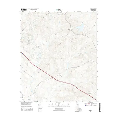
2014 Map of Marion
USGS Topo · Published 2014About this map
Fitzpatrick and Marion anchor this survey of the Twiggs County landscape, where the terrain is defined by the winding paths of Savage Cr and Flat Cr. The area is notably dense with small family and community burial grounds, providing a significant resource for genealogical research. Locations such as the Linda Melton Late Cem, Jones- Denison Cem, and Beech Spring Cem are scattered throughout the quadrangle, often situated near historical crossroads like those found along Bullard Rd and Marion Ripley Rd. In the south, the settlement of Bullard sits near the junction of US-129-Alt, while the northern portion is marked by water bodies like Lanier Lake and Mallory Lake. The map illustrates a rural Georgia community where traditional land divisions and local landmarks remain clearly delineated.
Find a feature on this map
46 named features on this map. Tap any name to fly to it.
Don’t see what you’re looking for? This feature index may not catch every label — zoom into the map to look around manually.
Map Details
Editions of this 2014 Marion Map
This is the sole edition of this map. No revisions or reprints were ever made.
Other maps of this area

1956 · Gordon
USGS Topo · 1:62,500

1956 · Warner Robins
USGS Topo · 1:62,500

1956 · Jeffersonville
USGS Topo · 1:62,500

1956 · Macon East
USGS Topo · 1:24,000

1956 · Macon
USGS Topo · 1:62,500

1957 · Macon
USGS Topo · 1:250,000

1958 · Macon
USGS Topo · 1:250,000

1964 · Macon
USGS Topo · 1:250,000

1973 · Massey Hill
USGS Topo · 1:24,000

1973 · Warner Robins NE
USGS Topo · 1:24,000