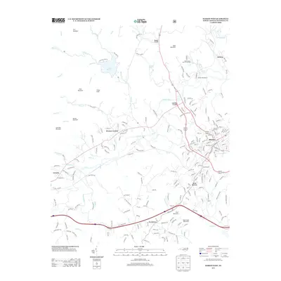
2013 Map of Marion West
USGS Topo · Published 2013About this map
The Catawba River winds through the foothills of the Blue Ridge, anchoring a landscape of small communities and industrial infrastructure west of the county seat. This 2013 survey highlights the expansion of Marion and its satellite settlements, including West Marion, Garden Creek, and Pleasant Gardens. The presence of the North Carolina State Fish Hatchery and Shiflet Field Airport north of the river suggests a region where state-managed resources and local aviation intersect with traditional mountain living. In the northwestern corner, Lake Tahoma sits amidst peaks such as Feds Mountain and Sheep Knob, illustrating the terrain's transition from the river valley to the higher summits. Transportation remains central to the area's identity, with the Norfolk Southern line following the river course and major arteries connecting rural Greenlee and Providence to the urban core.
Find a feature on this map
210 named features on this map. Tap any name to fly to it.
Don’t see what you’re looking for? This feature index may not catch every label — zoom into the map to look around manually.
Map Details
Editions of this 2013 Marion West Map
This is the sole edition of this map. No revisions or reprints were ever made.
Other maps of this area

1900 · Mount Mitchell
USGS Topo · 1:125,000

1902 · Mount Mitchell
USGS Topo · 1:125,000

1905 · Morganton
USGS Topo · 1:125,000

1934 · Parts Of Celo And Black Brothers
USGS Topo · 1:24,000

1934 · Parts Of Old Fort and Montreat
USGS Topo · 1:24,000

1953 · Charlotte
USGS Topo · 1:250,000

1954 · Charlotte
USGS Topo · 1:250,000

1955 · Knoxville
USGS Topo · 1:250,000

1956 · Ashford
USGS Topo · 1:24,000

1956 · Linville Falls
USGS Topo · 1:62,500