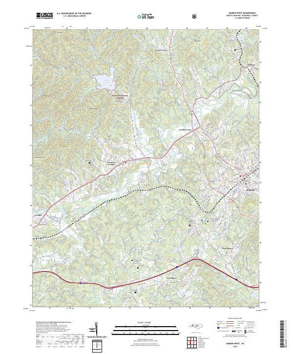
2022 Map of Marion West
USGS Topo · Published 2022About this map
Marion serves as the eastern anchor of this McDowell County landscape, where the Catawba River winds through a valley defined by the Habersham Mountains and the rising slopes of the Pisgah National Forest. The map documents a corridor of development following the Norfolk Southern rail line and the river, connecting settlements like Pleasant Gardens and Greenlee. Local history is anchored by numerous small burying grounds, including Barnes Cem and Zion Hill Cem, alongside the West Court Baptist Church Cem near the western edge of the county seat.
Find a feature on this map
189 named features on this map. Tap any name to fly to it.
Don’t see what you’re looking for? This feature index may not catch every label — zoom into the map to look around manually.
Map Details
Editions of this 2022 Marion West Map
This is the sole edition of this map. No revisions or reprints were ever made.
Other maps of this area

1900 · Mount Mitchell
USGS Topo · 1:125,000

1902 · Mount Mitchell
USGS Topo · 1:125,000

1905 · Morganton
USGS Topo · 1:125,000

1934 · Parts Of Celo And Black Brothers
USGS Topo · 1:24,000

1934 · Parts Of Old Fort and Montreat
USGS Topo · 1:24,000

1953 · Charlotte
USGS Topo · 1:250,000

1954 · Charlotte
USGS Topo · 1:250,000

1955 · Knoxville
USGS Topo · 1:250,000

1956 · Ashford
USGS Topo · 1:24,000

1956 · Linville Falls
USGS Topo · 1:62,500