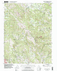
1998 Map of Mark West Springs
USGS Topo · Published 2002About this map
Mark West Springs and the surrounding Mayacamas Mountains are documented here in detail from imagery analyzed in the late 1990s. The landscape is defined by the complex drainage of Mark West Creek and its tributaries, including Porter Creek and Bidwell Creek, which carve through prominent rises like Telegraph Hill and Chalk Mtn. One of the most significant landmarks is the Petrified Forest, situated near the eastern boundary where Sonoma and Napa counties meet.
Find a feature on this map
32 named features on this map. Tap any name to fly to it.
Don’t see what you’re looking for? This feature index may not catch every label — zoom into the map to look around manually.
Map Details
Editions of this 1998 Mark West Springs Map
This is the sole edition of this map. No revisions or reprints were ever made.
Other maps of this area

1916 · Santa Rosa
USGS Topo · 1:62,500

1920 · Healdsburg
USGS Topo · 1:62,500

1927 · Calistoga
USGS Topo · 1:62,500

1933 · Healdsburg
USGS Topo · 1:48,000

1935 · Sebastopol
USGS Topo · 1:48,000

1940 · Healdsburg
USGS Topo · 1:62,500

1942 · Sebastopol
USGS Topo · 1:62,500

1943 · Calistoga
USGS Topo · 1:62,500

1944 · Santa Rosa
USGS Topo · 1:62,500

1945 · Calistoga
USGS Topo · 1:62,500