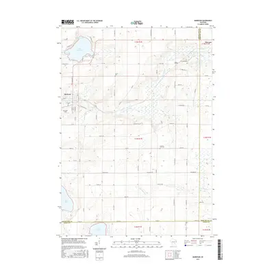
2015 Map of Markesan
USGS Topo · Published 2015About this map
The Grand River meanders through the heart of this landscape, connecting the regional centers of Markesan and Fairwater across a network of agricultural land and glacial lakes. This portion of Green Lake County is defined by its significant water bodies, including Little Green Lake in the northwest, which features named coves like Keartys Bay and Muskie Bay. Further south, the terrain opens into broader wetland complexes around Lake Maria and the headwaters of the S Br Rock River.
Find a feature on this map
71 named features on this map. Tap any name to fly to it.
Don’t see what you’re looking for? This feature index may not catch every label — zoom into the map to look around manually.
Map Details
Editions of this 2015 Markesan Map
This is the sole edition of this map. No revisions or reprints were ever made.
Other maps of this area

1915 · Neshkoro
USGS Topo · 1:48,000

1916 · Ripon
USGS Topo · 1:48,000

1918 · Neshkoro
USGS Topo · 1:62,500

1918 · Ripon
USGS Topo · 1:62,500

1955 · Randolph
USGS Topo · 1:62,500

1955 · Fox Lake
USGS Topo · 1:62,500

1956 · Ripon
USGS Topo · 1:62,500

1957 · Madison
USGS Topo · 1:250,000

1960 · Madison
USGS Topo · 1:250,000

1963 · Neshkoro
USGS Topo · 1:62,500