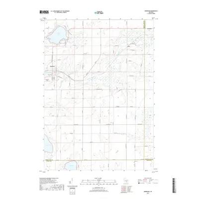
2018 Map of Markesan
USGS Topo · Published 2018About this map
Markesan serves as the primary hub of this landscape, situated along the Grand River in southwestern Green Lake County. The region is defined by its significant glacial hydrology, featuring Little Green Lake with its distinct Keartys Bay and Muskie Bay, alongside the expansive Lake Maria and Lake Emily. These water bodies are connected by a network of drainage systems including Drew Cr and the S Br Rock River.
Find a feature on this map
65 named features on this map. Tap any name to fly to it.
Don’t see what you’re looking for? This feature index may not catch every label — zoom into the map to look around manually.
Map Details
Editions of this 2018 Markesan Map
This is the sole edition of this map. No revisions or reprints were ever made.
Other maps of this area

1915 · Neshkoro
USGS Topo · 1:48,000

1916 · Ripon
USGS Topo · 1:48,000

1918 · Neshkoro
USGS Topo · 1:62,500

1918 · Ripon
USGS Topo · 1:62,500

1955 · Randolph
USGS Topo · 1:62,500

1955 · Fox Lake
USGS Topo · 1:62,500

1956 · Ripon
USGS Topo · 1:62,500

1957 · Madison
USGS Topo · 1:250,000

1960 · Madison
USGS Topo · 1:250,000

1963 · Neshkoro
USGS Topo · 1:62,500