2022 Map of Markesan
USGS Topo · Published 2022About this map
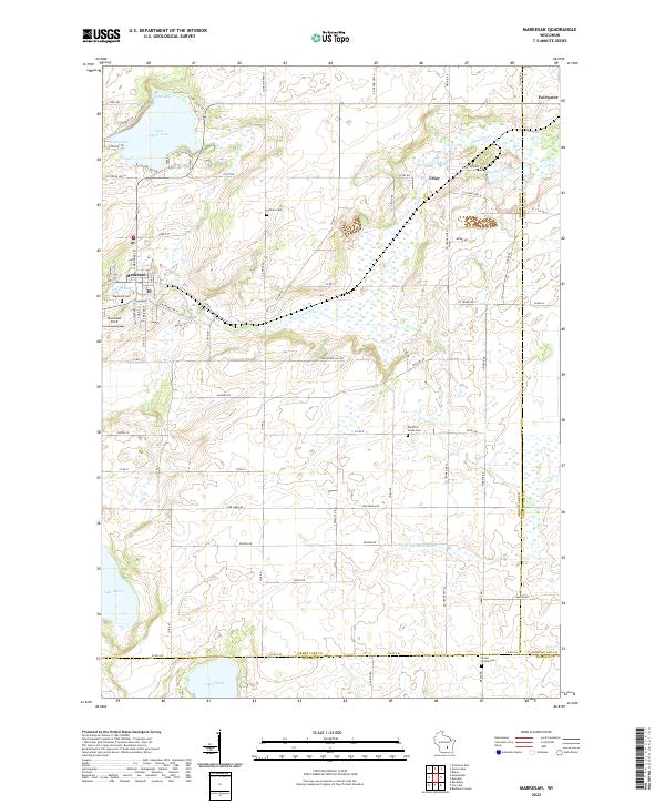
The city of Markesan serves as the focal point for this landscape in the early 2020s, situated where the Grand River meets the local transportation network of Co Rd S and Co Rd AS. The surrounding terrain is defined by a dense concentration of wetlands and lakes, including Little Green Lake with its distinct Keartys Bay and Muskie Bay, as well as Lake Maria and Lake Emily to the south. This area demonstrates a stable agricultural and rural pattern, punctuated by small unincorporated communities and several burial grounds that mark the local history of settlement, such as Tichora Cem, Mackford Union Cem, and Grand Prairie Cem. The presence of Utley and Fairwater along the northeastern edge of the sheet reflects the persistent, small-scale settlement patterns of Green Lake County, while the rising elevations of Mackford Hill provide a rare point of relief in this water-heavy prairie environment.
Find a feature on this map
76 named features on this map. Tap any name to fly to it.
Don’t see what you’re looking for? This feature index may not catch every label — zoom into the map to look around manually.
Map Details
Editions of this 2022 Markesan Map
This is the sole edition of this map. No revisions or reprints were ever made.