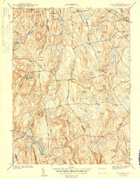
1944 Map of Marlboro
USGS Topo · Published 1944About this map
Marlboro and the surrounding borderlands of Hartford and Tolland counties are meticulously documented in this mid-war survey. The landscape is defined by the Blackledge River and numerous tributaries like Sawmill Brook and Fawn Brook that feed into the Salmon River. Evidence of early industrial activity persists at Shoddy Mill in the northern section, while the local infrastructure is anchored by several rural schoolhouses, including Bolton South Sch and the Northwest Sch.
Find a feature on this map
55 named features on this map. Tap any name to fly to it.
Don’t see what you’re looking for? This feature index may not catch every label — zoom into the map to look around manually.
Map Details
Editions of this 1944 Marlboro Map
5 editions found
Other maps of this area

1892 · Hartford
USGS Topo · 1:62,500

1892 · Tolland
USGS Topo · 1:62,500

1892 · Gilead
USGS Topo · 1:62,500

1893 · Middletown
USGS Topo · 1:62,500

1906 · Farmington
USGS Topo · 1:125,000

1921 · Tolland
USGS Topo · 1:62,500

1928 · Glastonbury
USGS Topo · 1:24,000

1928 · Manchester
USGS Topo · 1:24,000

1944 · Manchester
USGS Topo · 1:31,680

1944 · Marlboro
USGS Topo · 1:31,680