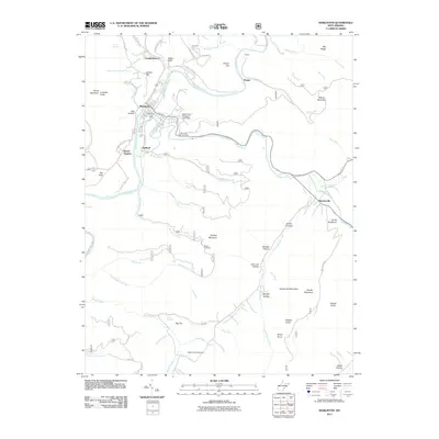
2011 Map of Marlinton
USGS Topo · Published 2011About this map
The Greenbrier River and Knapp Creek converge at Marlinton, the central hub of this Pocahontas County landscape. The settlement pattern follows the narrow valley floors, with Campbelltown to the north and Beard Heights and Stillwell positioned along the river corridor to the south. The topography is defined by high ridges like Marlin Mountain and Buckley Mountain, where the terrain rises sharply from the watercourses. Local family history is preserved at the Mountain View Cemetery, Messir Cemetery, and Beaver Creek Cemetery. Historically significant sites like Huntersville sit further east along Knapp Creek, while civic infrastructure is noted at the Marlinton Post Office and the Marlin Run Structure One Dam. Numerous hollows, such as Kee Hollow and Gilden Hollow, suggest the deep-cut drainage patterns of the Allegheny Mountains, where small runs like Sunday Lick Run and Monday Lick Run feed the primary river system.
Find a feature on this map
71 named features on this map. Tap any name to fly to it.
Don’t see what you’re looking for? This feature index may not catch every label — zoom into the map to look around manually.
Map Details
Editions of this 2011 Marlinton Map
This is the sole edition of this map. No revisions or reprints were ever made.
Other maps of this area

1891 · Huntersville
USGS Topo · 1:125,000

1894 · Huntersville
USGS Topo · 1:125,000

1901 · Monterey
USGS Topo · 1:125,000

1922 · Cass
USGS Topo · 1:48,000

1923 · Marlinton
USGS Topo · 1:48,000

1923 · Warm Springs
USGS Topo · 1:48,000

1923 · Mingo
USGS Topo · 1:48,000

1924 · Cass
USGS Topo · 1:62,500

1925 · Mingo
USGS Topo · 1:62,500

1925 · Marlinton
USGS Topo · 1:62,500