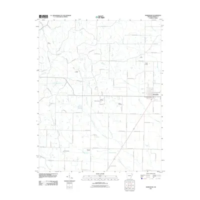
2011 Map of Marmaduke
USGS Topo · Published 2011About this map
Marmaduke serves as the primary hub of this eastern Arkansas landscape, where a dense network of county roads organizes the agricultural terrain. The town's grid is anchored by the Marmaduke Post Office, while the surrounding countryside is defined by several creek systems including Slavens Creek, Hurricane Creek, and Pigeon Roost Creek. A significant number of small family and community burial grounds are scattered across the quadrangle, including Talken Cemetery, Wright Cemetery, and the Friends Cemetery near the southern edge. The distribution of these sites, alongside others like Harveys Chapel Cemetery and Old Liberty Cemetery, suggests a long-settled rural community with deeply rooted local lineages. Water management and drainage are central to the geography here, evidenced by landmarks such as the Dickeys Lake Dam and the meandering paths of Culver Creek and Henderson Creek.
Find a feature on this map
84 named features on this map. Tap any name to fly to it.
Don’t see what you’re looking for? This feature index may not catch every label — zoom into the map to look around manually.
Map Details
Editions of this 2011 Marmaduke Map
This is the sole edition of this map. No revisions or reprints were ever made.
Other maps of this area

1935 · Rector
USGS Topo · 1:62,500

1935 · Knobel
USGS Topo · 1:62,500

1940 · Gainesville
USGS Topo · 1:62,500

1940 · Marmaduke
USGS Topo · 1:62,500

1941 · Knobel
USGS Topo · 1:62,500

1957 · Poplar Bluff
USGS Topo · 1:250,000

1958 · Marmaduke
USGS Topo · 1:62,500

1958 · Gainesville
USGS Topo · 1:62,500

1958 · Rector
USGS Topo · 1:62,500

1959 · Poplar Bluff
USGS Topo · 1:250,000