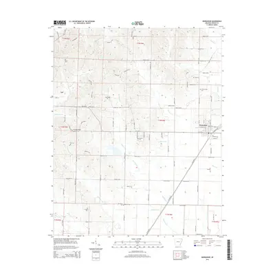
2014 Map of Marmaduke
USGS Topo · Published 2014About this map
Crowleys Ridge defines the topography of this Greene County landscape, rising distinctly above the flatter drainage basins of the St. Francis River valley. This 2014 survey documents the eastern Arkansas borderlands, where the elevated ridge provides a natural platform for rural settlements and family burial grounds. The city of Marmaduke sits at the intersection of agricultural transport routes, including Railroad Ave and the highway network. To the west, the smaller community of Lafe serves as a local hub near the ridge's edge. This map is particularly valuable for genealogists, as it meticulously identifies numerous small cemeteries such as Harveys Chapel Cem, Old Liberty Cem, and Hartsoe Cem, many of which are associated with the earliest homesteading families of the region. The drainage patterns of Hurricane Creek and Henderson Creek illustrate the complex water management necessary in this alluvial plain.
Find a feature on this map
99 named features on this map. Tap any name to fly to it.
Don’t see what you’re looking for? This feature index may not catch every label — zoom into the map to look around manually.
Map Details
Editions of this 2014 Marmaduke Map
This is the sole edition of this map. No revisions or reprints were ever made.
Other maps of this area

1935 · Rector
USGS Topo · 1:62,500

1935 · Knobel
USGS Topo · 1:62,500

1940 · Gainesville
USGS Topo · 1:62,500

1940 · Marmaduke
USGS Topo · 1:62,500

1941 · Knobel
USGS Topo · 1:62,500

1957 · Poplar Bluff
USGS Topo · 1:250,000

1958 · Marmaduke
USGS Topo · 1:62,500

1958 · Gainesville
USGS Topo · 1:62,500

1958 · Rector
USGS Topo · 1:62,500

1959 · Poplar Bluff
USGS Topo · 1:250,000