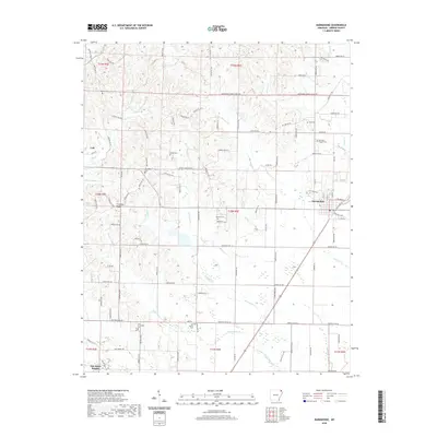
2020 Map of Marmaduke
USGS Topo · Published 2020About this map
Crowleys Ridge rises above the flat agricultural plains of Greene County, providing a distinct topographic break that has long influenced the placement of roads and homesteads in the region. The city of Marmaduke is positioned along the Union Pacific rail corridor, while the smaller communities of Lafe and Oak Grove Heights anchor the western portion of the quadrangle. The map is particularly notable for its dense concentration of small family and community burial grounds, such as Harvey's Chapel Cem, Wright Cem, and Providence Cem, which are scattered throughout the rural landscape. A network of waterways including Hurricane Cr, Slavens Cr, and Henderson Cr drain the lowlands, reflecting the intricate drainage patterns necessary for local agriculture between the ridge and the river systems further east.
Find a feature on this map
114 named features on this map. Tap any name to fly to it.
Don’t see what you’re looking for? This feature index may not catch every label — zoom into the map to look around manually.
Map Details
Editions of this 2020 Marmaduke Map
This is the sole edition of this map. No revisions or reprints were ever made.
Other maps of this area

1935 · Rector
USGS Topo · 1:62,500

1935 · Knobel
USGS Topo · 1:62,500

1940 · Gainesville
USGS Topo · 1:62,500

1940 · Marmaduke
USGS Topo · 1:62,500

1941 · Knobel
USGS Topo · 1:62,500

1957 · Poplar Bluff
USGS Topo · 1:250,000

1958 · Marmaduke
USGS Topo · 1:62,500

1958 · Gainesville
USGS Topo · 1:62,500

1958 · Rector
USGS Topo · 1:62,500

1959 · Poplar Bluff
USGS Topo · 1:250,000